
Katong’s Four-Road Junction: Mountbatten Meets East Coast
There is a junction in Katong where “just carry on down the road” needs a footnote.
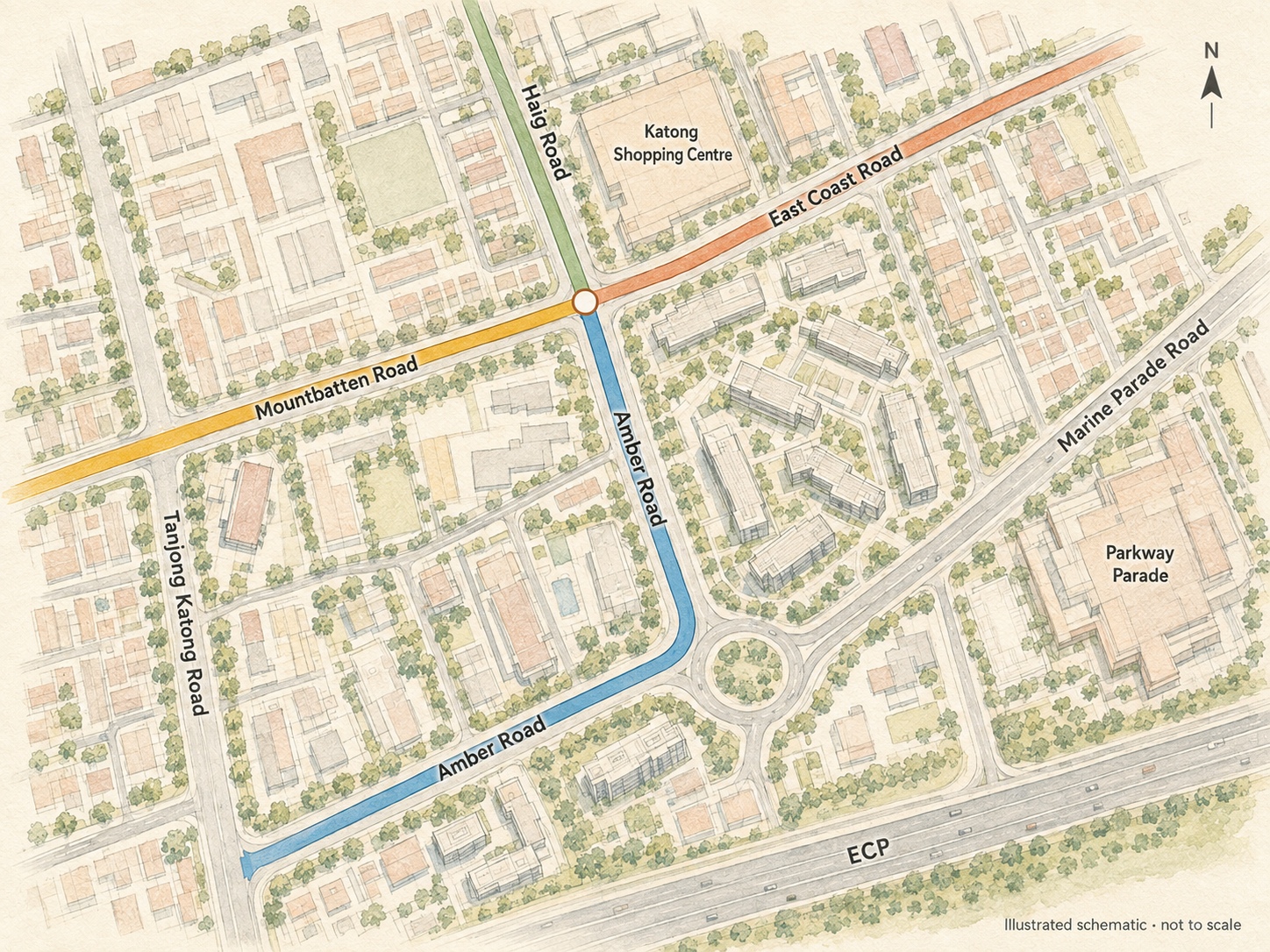
Mountbatten Road arrives from one side and leaves as East Coast Road. Haig Road becomes Amber Road. Then Amber bends around the block, keeping its name.
I have heard taxi drivers pause over the same question I was asking: which road are we on now?
The crossing is beside Katong Shopping Centre, in eastern Singapore. Easy enough to find. Rather harder to describe.
Four road names, one junction
On the illustration, orange Mountbatten becomes red East Coast. Across them, green Haig becomes blue Amber. Follow blue south and it bends back towards Tanjong Katong Road.
Katong Shopping Centre marks the northern corner; the roundabout and Parkway Parade help place the bend farther south. Better landmarks than “somewhere on Amber”.
Open the illustration full size, or find the junction on Google Maps. Buildings and minor streets in the drawing are simplified.
And there used to be a beach
Looking into the road names sent me on a better detour: this neighbourhood used to be beside the sea.
URA’s history of Mountbatten describes Grove Estate, a coconut plantation between the old shoreline and Grove Road — today’s Mountbatten Road. Beachside bungalows followed.
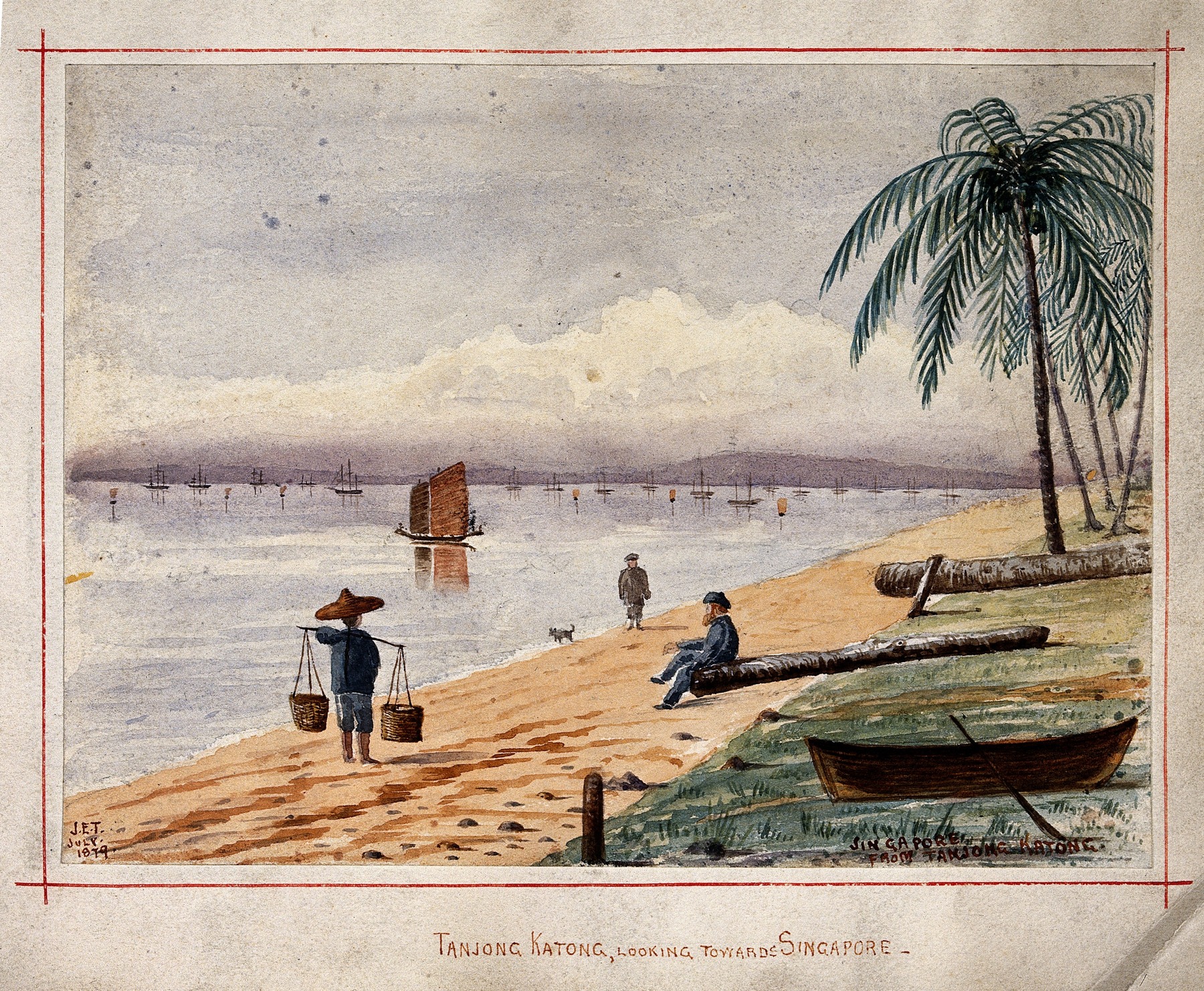
My favourite detail comes from the National Library’s account of architect Lee Kip Lin’s home. His Amber Road house, rebuilt in 1960, had a garden separated from the beach by a wall and a gate. Upstairs, the living room opened onto a balcony facing the sea.
Then land reclamation in the 1960s pushed the shoreline out. I find it hard to walk around Amber today and picture a garden gate opening onto the beach.
Does that explain the bend or the changing names? I haven’t found an answer to that exact question. The old coast is a fascinating detour, though.
Meanwhile: go straight, change roads. Turn a corner, stay on the same one.
First noted in February 2025; historical background and illustrated map added in September 2026.

What would confuse you more at this junction?
Loading responses…
.jpg)